San Rafael residents who live, work, or shop in the Southeast neighborhood can now help shape a long-range plan for one of the city's most flood-vulnerable areas.
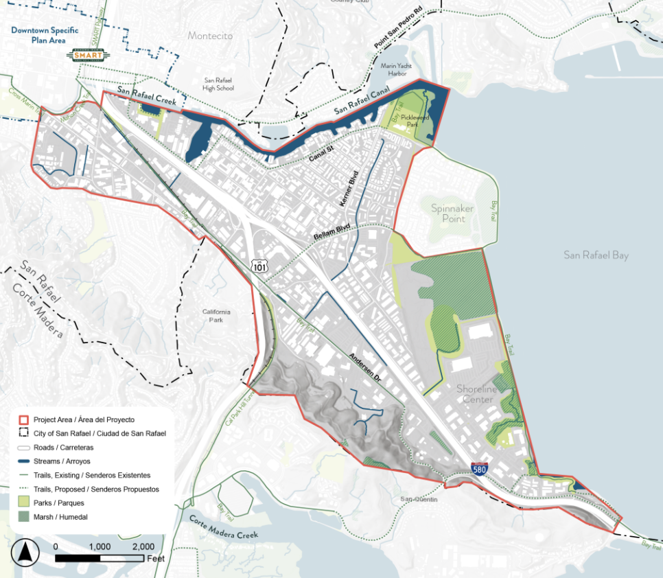
The City of San Rafael announced on July 9 that the Southeast San Rafael Specific Plan process is underway. The effort will guide decisions on housing, jobs, transportation, public space, and flood resilience across a district home to San Rafael's largest Latino community, key employment centers, and essential workforce housing.
According to FEMA's National Risk Index, southeast San Rafael faces greater flood risk than 99% of census tracts nationwide. Sea level rise and recurring flooding will be central to the plan's direction.
How to get involved
The city outlined several ways residents can participate:
- Sign up for email updates through the online form at cityofsanrafael.org/southeast-san-rafael-specific-plan/.
- Attend Community Event #1 in fall 2026 to help identify priorities and future planning directions. A specific date and venue have not been announced.
- Attend Community Event #2 and complete an online survey in spring 2027 to review plan alternatives.
- Submit comments anytime through the project website's comment form.
The project website is available in both English and Spanish.
Timeline and scope
The planning process runs roughly two years across three phases:
- Phase 1 (spring through summer 2026): Identifying issues and opportunities
- Phase 2 (fall 2026 through spring 2027): Developing alternatives and community prioritization
- Phase 3 (summer 2027 through spring 2028): Policy recommendations, plan development, and environmental impact report
A Technical Advisory Committee with representatives from city departments, partner agencies, and technical experts will provide guidance at key milestones.
Years of groundwork
The Specific Plan builds on General Plan 2040 and years of Canal-area planning. Between 2022 and 2026, the city and partners including the County of Marin, Multicultural Center of Marin, Canal Alliance, and UC Berkeley conducted more than 150 presentations, focus groups, surveys, and workshops in English and Spanish, directly engaging more than 5,000 people on sea level rise planning alone. That work was funded by the State Coastal Conservancy, Marin Community Foundation, and the Governor's Office of Land Use and Climate Innovation.
A City Council presentation on sea level rise feasibility and next steps for flood planning is scheduled for Monday, August 17, 2026.